Mountain biking tours
Tour tips from mountain bikers for mountain bikers in the Salzkammergut

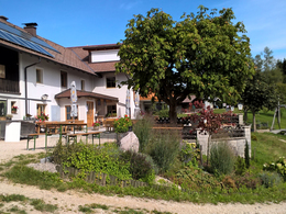
Your hosts Andrea and Bernhard are well acquainted with the region - Bernhard himself moreover is a certified mountainbike-guide. They both are at your disposal in the mornings and evenings for tour tips for mountain bikers in the Salzkammergut.
Landhotel Agathawirt has a wide range of offers for mountain bikers:
- We offer: 3 guided tours per week in at least 2 ability groups. At least 1 additional easy tour per week for beginners. Euro 85,- per tour and person.
- For e-mountain bikers there are special guided e-mountain bike tours incl. technique training. From 2 persons - Euro 170,- per tour.
Our special mountain biking tour tips
- the Hallstättersee-Koppenwinkel-Round – 30 km, 150 metres of change in altitude – wonderful sight to the village of Hallstatt – nature of Koppenwinkelsee
- the Weissenbach Round – 21 km, 240 metres of change in altitude – our tour for the afternoon after your trip
- the Hochmuth-Round – 23 km, 500 meters of change in altitude – nice tour for half- a – day
- the Blaa-Alm Round– 45.5 km, 960 metres of change in altitude – a classic to get started and get to know the region, but also THE tour to take when it is very hot, since most of the change in altitude has to be conquered at the beginning of the tour and Altaussee Lake is a welcome stop off to cool down

- the Kaiser Tour – 38 km, 770 metres of change in altitude – The tour doesn't just earn its name Kaiser Tour because it leads through the forests and along the paths that Franz and Sis once travelled on foot and by carriage, but primarily because of the highlights it offers. You will see the Ewige Wand and the Tauernweg to Ischl and it has lots of cozy cabins with the Ratluck'n and Hoisenradalm to offer.
- the Sandling-Round - 35 km, 1350 metres of change in altidude – have a break at lake Altausee and a Kaiserschmarrn at the Hütteneck-hut
- the Raschberg Round – 52.50 km, 1,610 metres of change in altitude – Into the Ausseerland and over the challenging Grabenbach back up to the Raschberg – marvelous view of one of the best-known mountain meadows in the Salzkammergut – the Hütteneckalm – the Kaiserschmarrn alone is reason enough for a visit!
- the Durchgangsalm-Round – 48 km, 1380 Hütteneckalm – The tour starts on Lake Hallstatt and leads along the new bike path with a view of the world-famous city of Hallstatt before the path becomes steep in the Echerntal on the way to Gosau – a tour that offers everything – beautiful views, cosy meadows, challenging inclines and declines.
- the Salzkammergut 5 Lake Tour (lake Wolfgangsee, Schwarzensee, etc.) – 60 km, 1350 Hütteneckalm – Mountains and lakes: a combination that the Salzkammergut presents spectacularly, beautiful views and also very appropriate for bikers who without a lot of technical skills.
The team of Landhotel Agathawirt will be happy to help you with your mountain bike plans. Send us your no-obligation enquiry for your mountain bike holidays today.
Mountain bike tours in the Salzkammergut
Find the perfect tour for you. Filter the mountain bike tours according to criteria such as altitude, kilometres, duration, difficulty or riding technique. Then download the tour data as a PDF file or GPS data and look forward to your MTB day in the Salzkammergut.
Schörfling-Hongar-Radtour


At the train station in Kammer, Schörfling am Attersee the bike path starts and from there it continues towards Weyregg and to Aurach am Attersee. The bike tour is ideal for sporty cyclists and offers, among other things, a wide range of gastronomy.
- Start at Kammer-Schörfling train station in the left, direction to Weyregg.
- After 50m turn left again into the center of Schörfling. Follow the signage cycle path "R2".
- After 800m we reach the town hall. From there, follow the R2 cycling path towards Aurach.
- Km 1.6, we cross the federal road and continue on the left along the cycle route R2 towards Aurach.
- At km7 in the village Aurach turn right direction to Kasten-Hongar. Follow the road to the Almgasthof Schwarz.
- Km 11,1 we turn left to the Almgasthof Schwarz.
- After 12.4km we reach the Almgasthof. Highest point of the tour.
- From Almgasthof Schwarz take the road again 1.3 km and turn left into the forest road Hongar-Gahberg.
- At km 16,5 bifurcation, turn left direction to Hongar – Gahberg.
- After 20km turn right downhill towards Hongar – Gahberg.
- 20,5 km bifurcation, keep on the left.
- After 23km end of the forest road. Turn right into the asphalt road.
- Km 23,8 Keep left at the crossroad.
- At km 24,6, another crossroad, keep left again.
- After 26.5 km we have reached Schörfling again. We drive towards the center and from the center (town hall).
Refreshment stops:
- Starting point: See-Imbiss (lake snack-bar), or a variety of restaurants and inns in Schörfling
- On the route: Gastronomic Operators in Aurach and Almgasthof Schwarz
- Beautiful garden with a view to the "Höllengebirge" at the Almgasthof Schwarz
Paths covering:
further information:
- Flatly
- Board possible
details mountainbike
- Riding technique: medium
Spring till autumn!
Accessibility / Arrival
By car:From Salzburg via the A1 - Seewalchen exit
From Vienna/Linz via A1 - exit Schörfling or Seewalchen
From the west - Bad Ischl-Weißenbach-Steinbach-Weyregg-Schörfling
By train:
Coming from Salzburg or Linz/Vienna to Attnang-Puchheim or Vöcklabruck - continue with the Kammer Bahn to BH Kammer Schörfling.
Plane:
From Salzburg via the A1 - Seewalchen exit.
From Vienna/Linz via A1 - exit Schörfling or Seewalchen
Parking possibilities:
- Train station Kammer Schörfling
- Freeway exit Seewalchen, opposite Eurospar in Seewalchen
- Parking space: 40
- All weather
- Suitable for groups
- Suitable for schools
- Suitable for teenagers
- Suitable for seniors
- Suitable for single travelers
- Suitable for friends
- Suitable for couples
- Spring
- Summer
- Autumn
- Early winter
Please get in touch for more information.
4864 Attersee am Attersee
Phone +43 7666 7719 - 0
Fax machine +43 7666 7719 - 19
E-Mailinfo.schoerfling@attersee.at
Webwww.asc-attersee.at
Webattersee-attergau.salzkammergut.at
https://attersee-attergau.salzkammergut.at
You can also visit us on
Facebook")
")
")


