Mountain biking tours
Tour tips from mountain bikers for mountain bikers in the Salzkammergut
Your hosts Andrea and Bernhard are well acquainted with the region - Bernhard himself moreover is a certified mountainbike-guide. They both are at your disposal in the mornings and evenings for tour tips for mountain bikers in the Salzkammergut.
Landhotel Agathawirt has a wide range of offers for mountain bikers:
- We offer: 3 guided tours per week in at least 2 ability groups. At least 1 additional easy tour per week for beginners. Euro 85,- per tour and person.
- For e-mountain bikers there are special guided e-mountain bike tours incl. technique training. From 2 persons - Euro 170,- per tour.
Our special mountain biking tour tips
- the Hallstättersee-Koppenwinkel-Round – 30 km, 150 metres of change in altitude – wonderful sight to the village of Hallstatt – nature of Koppenwinkelsee
- the Weissenbach Round – 21 km, 240 metres of change in altitude – our tour for the afternoon after your trip
- the Hochmuth-Round – 23 km, 500 meters of change in altitude – nice tour for half- a – day
- the Blaa-Alm Round– 45.5 km, 960 metres of change in altitude – a classic to get started and get to know the region, but also THE tour to take when it is very hot, since most of the change in altitude has to be conquered at the beginning of the tour and Altaussee Lake is a welcome stop off to cool down
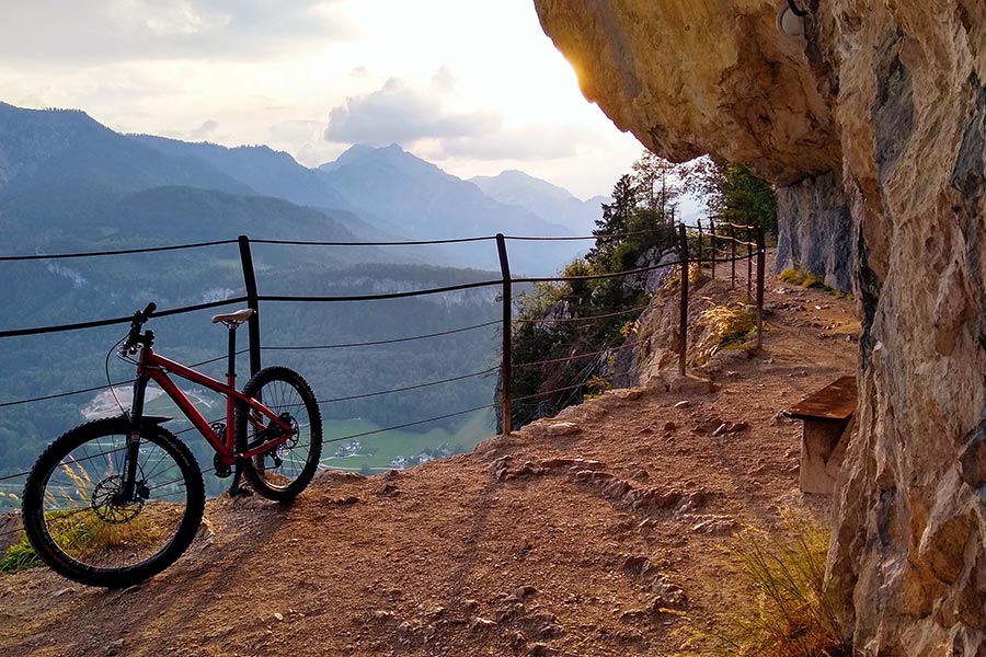
- the Kaiser Tour – 38 km, 770 metres of change in altitude – The tour doesn't just earn its name Kaiser Tour because it leads through the forests and along the paths that Franz and Sis once travelled on foot and by carriage, but primarily because of the highlights it offers. You will see the Ewige Wand and the Tauernweg to Ischl and it has lots of cozy cabins with the Ratluck'n and Hoisenradalm to offer.
- the Sandling-Round - 35 km, 1350 metres of change in altidude – have a break at lake Altausee and a Kaiserschmarrn at the Hütteneck-hut
- the Raschberg Round – 52.50 km, 1,610 metres of change in altitude – Into the Ausseerland and over the challenging Grabenbach back up to the Raschberg – marvelous view of one of the best-known mountain meadows in the Salzkammergut – the Hütteneckalm – the Kaiserschmarrn alone is reason enough for a visit!
- the Durchgangsalm-Round – 48 km, 1380 Hütteneckalm – The tour starts on Lake Hallstatt and leads along the new bike path with a view of the world-famous city of Hallstatt before the path becomes steep in the Echerntal on the way to Gosau – a tour that offers everything – beautiful views, cosy meadows, challenging inclines and declines.
- the Salzkammergut 5 Lake Tour (lake Wolfgangsee, Schwarzensee, etc.) – 60 km, 1350 Hütteneckalm – Mountains and lakes: a combination that the Salzkammergut presents spectacularly, beautiful views and also very appropriate for bikers who without a lot of technical skills.
The team of Landhotel Agathawirt will be happy to help you with your mountain bike plans. Send us your no-obligation enquiry for your mountain bike holidays today.
Mountain bike tours in the Salzkammergut
Find the perfect tour for you. Filter the mountain bike tours according to criteria such as altitude, kilometres, duration, difficulty or riding technique. Then download the tour data as a PDF file or GPS data and look forward to your MTB day in the Salzkammergut.
Kalkalpen Trail Stage 3


Kalkalpen Trail Stage 3 - Wilderness & Wild Animals: ANLAUFALM - EBENFORSTALM
The 3rd stage leads you from Anlaufalm into the wilderness of the Kalkalpen National Park. Across the Große Klause to Ebenforstalm.
Recommended season:
- March
- April
- May
- June
- July
- August
- September
- October
- November
The trail leads flat from Anlaufalm along a tractor path over the pasture area. After a slight curve, you can enjoy beautiful panoramic views of the national park again. After a few minutes of walking, the path turns left off the tractor path toward a small brook. Even from afar, a hiking trail marker can be seen in the middle of the pasture. At this junction, you turn left over the Hochschlacht (variant – see description) to Schleier Waterfall and via the Trifftsteig through the Große Schlucht to Annerlsteg – this variant is particularly scenic and leads through a unique natural landscape, but is only recommended for experienced hikers because the descent over the Hochschlacht is very steep.
To the right, the path enters the forest after a few steps and initially remains flat. After a few minutes of walking in the forest, the path descends steeply in a zigzag over a short stretch to an old forestry road. This old forestry road forms the border of the national park and runs flat for several minutes. Eventually, the path branches right off the road in a right curve into the forest. If you were to continue straight on the forestry road, you would reach the turnoff that leads back right towards Brunnbach.
At the turnoff, the path goes steeply downhill into the forest after a few steps. To the left, the slope descends very steeply. The path continues steeply downhill and finally crosses a small stream that only carries water when it rains. You follow the course of the stream downstream until the path finally joins an old forestry road again by a wooden ladder.
You continue following the old forestry road to the right, relatively flat, until the next intersection. To the right, the forestry road would go again towards Brunnbach. To the left, right at the junction, you take the path via the Keixen to the Große Bach. On an old tractor path, you leisurely walk downhill until you reach a meadow with the dilapidated hut "Keixen" (former hunting lodge). Passing the hut to the right, the path leads back into the forest on an old forestry road down to the Große Bach.
Along the Große Bach, you walk comfortably on the Hintergebirgs cycle path downstream for about 20 minutes to the Große Klaushütte (488 m). The Große Klaushütte was once the quarters of the woodcutters in the Hintergebirge and is now a popular place to stop.
After refreshment at the Große Klaushütte, you reach a tunnel after a few minutes walking. Left before the tunnel is the “Kleine Klaushütte,” from where you can also get a view of the former Große Klause. Upon entering the tunnel, the lighting switches on automatically after a few steps. Right after the tunnel, a few steps lead down to the former Große Klause.
Since the Middle Ages, the Reichraminger Hintergebirge has been used for timber harvesting. To transport the wood out of the Hintergebirge, the rivers were used for timber rafting. At various points, wood dams (stauwerke) were built, and in spring, with the meltwater, the wood was floated down to Reichraming. The Große Klause was the largest of its kind and also the last one before Reichraming. From here, all wood was floated to Reichraming using a dam release (“Klausenschlag”). Due to a bark beetle catastrophe, a forest railway was eventually built into the Hintergebirge, replacing timber rafting. It ran for the last time in 1971. Today, nature lovers again have the opportunity to experience the national park by bike on the former railway route along the Hintergebirgs cycle path.
Through the second tunnel, the path continues very flat on the Hintergebirgs cycle path downstream to the first turnoff, which goes left over the Große Bach at the “Rabenbachbrücke” bridge. Here begins the Begsteigersteig trail to Ebenforstalm.
Immediately after the bridge, the path leads right, flat along a forestry road, alongside the Große Bach through a beech forest. The forestry road gradually climbs gently and you hike further and further above the Große Bach. Eventually, you reach a left curve, from which the forestry road leads away from the Große Bach valley into Kohlersgraben. Here also joins the 2nd ascent of the Begsteigersteig from Wasserboden into the path. You follow the forestry road until shortly after the next hairpin turn, where the path at a junction turns right into an old abandoned forestry road. From here, it goes a bit steeper up to the end of the old forestry road to an old turning area. At the end of this turning area, the hiking trail continues up a beautiful forest path towards Ebenforstalm. This old haulage path, if followed further, would connect via Klaushof to Ebenforstalm. Halfway along, the Begsteigersteig turns right though, marked by piles of stones (Stoamandln).
From here, a narrow path runs partly downhill along the slope down to the brook. The brook only carries some water when it rains, so you can cross it without any problems. After crossing the brook, take a moment to gather strength. The next 150 to 200 meters run zigzag very steeply uphill through the forest. Rope protections help on the somewhat strenuous ascent. After this short effort, you come again to a flatter section along the slope below a rock wall and onto a nice forest path above the ravine. Some caution is advised here because the slope falls away very steeply to the left. Along the path, you will repeatedly find interesting dead trees covered with fungi. Finally, the path turns right and, across the forest floor and past an old stone wall, leads to a forestry road.
From here, it is not far to Ebenforstalm. You follow the forestry road left for a few minutes flat to a junction, where you take the forestry road branching right. After a few minutes walking, you reach another fork where you go straight ahead.
After a few steps, you reach the starting point of the themed trail “Cotton Grass, Alp, and Water Sinkholes.” Rich alpine meadows, cotton grass, formed moors, and deep green spruce forests hide many secrets. A lively bubbling spring brook suddenly disappears into the forest, inconspicuous peat tells the story of 8,000 years, and the rocky ledges of Trämpel and Alpstein reveal that the entire geology has been overturned. This themed trail shows the diversity of the mountain world at Ebenforst. A wooden boardwalk leads just above the forest and alpine ground through this fascinating area. In late spring, the alpine ground blooms with globe flowers, peat mosses, two species of cotton grass, sundew, and various orchids like broad-leaved marsh orchid, fly orchis, and fox orchid.
From the alpine ground, you can already see somewhat above the Ebenforstalm, today's stage destination.
Paths covering:
further information:
- Possible accommodation
Details - hiking
- themed path

Die bewirschaftete Anlaufalm liegt im Reichraminger Hintergebirge und ist über Wanderwege und mit dem Mountainbike gut erreichbar.
Hüttenwirt:in Andi und Melanie
- Für Übernachtung ist bitte eine Reserviergung erforderlich!
Anfragen und Buchungen unter +43 676/335 12 77 - E-Bike Ladestation bei Almgebäude

Nach dem Tunnel bei der Großen Klause ist rechts ein kurzer Abstecher zur Kleinen Klaushütte möglich. Das Wasser reichte hier bei vollem Klaushof bis knapp unter die Hütte. Einstemmungen im Fels zeugen von der einstigen Klause. Von hier ist man in wenigen Minuten bei der Große Klaushütte, dem Ziel des Buchensteiges.
2. Etappe: Wilder Graben bis Große Klaushütte
Über 500 Jahre lang war die Holztrift die einzige Möglichkeit, die gefällten Baumstämme aus den Schluchten des Hintergebirges heraus bis nach Reichraming zu transportieren. In den Bächen wurden meist hölzerne Klausen errichtet, um das Wasser aufzustauen und dann abzulassen. Mit dem so erzeugten künstlichen Hochwasser wurden die Stämme kilometerweit getriftet, bis sie von einem Rechen wieder aufgefangen wurden. Erstmals 1604 als „Mitterwendt Claus“ urkundlich erwähnt, ist die Große Klause die älteste im Hintergebirge. Für die Triftstrecke von 11,6 Kilometer bis zum Schallauer Rechen bei Reichraming brauchte das Holz eine Stunde. Als letzter Rest der Klause ist nur noch die untere Schwelle erhalten, die heute als Geschiebesperre dient. Mit einer Stauhöhe von 8,8 Metern konnte man einen 130.000 m2 großen Klaushof (das ist der See hinter der Klause) aufstauen, der zirka 255.000 m3 Wasser fasste. Die Kraft des Wassers war gewaltig, wenn beim Schlagen der Klaustore der Wasserschwall die Holzbloch mit sich riss! 1923 wurde die Holzkastenklause zum letzten Mal neu gebaut, 1937 zum letzten Mal getriftet. Mit dem Bau der Waldbahn konnten die Stämme nun mit der Bahn nach Reichraming transportiert werden. Bis 1971 war die Schmalspurbahn in Betrieb, auf deren Trasse später die Forststraßen gebaut wurden und heute Wanderer und Radfahrer unterwegs sind.
Die Große Klaushütte (488 Meter)
Seehöhe Die urige Holzknechthütte wurde 1758 erbaut und diente den Forstarbeitern als Unterkunft. Die Stämme der Blockhütte sind noch zugehackt und nicht gesägt. Die Säge wurde erst im Jahr 1777 verpfl ichtend eingeführt, bis dahin wurden die Bäume mit der Axt gefällt und bearbeitet. Heute ist die Große Klaushütte ein beliebtes Ausfl ugsziel am Hintergebirgs-Radweg.

Anschließend quert der Weg über einen kurzen Holzsteg den Kohlersgraben. Hier zweigt der Begsteigersteig Richtung Ebenforstalm ab. Der Buchens teig führt geradeaus weiter, immer in Bachnähe, bis er in eine Schotterstraße einmündet. Bei der Rabenbachbrücke überquert man den Großen Bach und wandert das letzte Stück etwa 15 bis 20 Minut en bachaufwärts auf der Forststraße am Hintergebirgs-Radweg, vorbei an der Großen Klause, bis zur Großen Klaushütte.
2. Etappe: Wilder Graben bis Große Klaushütte
Unterhalb des Holzsteges entspringt auf Höhe des Großen Baches eine typische Karstquelle. Die so genannte Predigtstuhl Quelle wird vom Nationalpark Kalkalpen seit 1993 regelmäßig beprobt. Sie entwässert den Ebenforstbach, der auf der Ebenforstalm in etwa 1.000 Meter Seehöhe im Bereich des Nationalpark Themenweges „Wollgras, Alm und Wasserschwinde“ in einem Schluckloch verschwindet und dann unterirdisch weiterfl ießt. Karstquellen zeigen im Jahresverlauf oft nur geringe Termperaturschwankungen. Bei der Predigtstuhl Quelle sind hingegen die Schwankungen zwischen 4 und 12 Grad Celsius durch den Einfl uss des Ebenforstbaches sehr auff ällig. Bei Hochwasser ist auch die kleine Höhle oberhalb des Holzsteges wasserführend. Durch die Almwirtschaft ist vor allem in den Sommermonaten eine Keimbelastung gegeben, daher ist die Quelle nicht als Trinkwasser geeignet.

Die Ebenforstalm liegt am Fuße von Trämpl und Alpstein im Reichraminger Hintergebirge. Die Alm-Jausenstation mit Übernachtungsmöglichkeit ist von 1. Mai bis 31. Oktober bewirtschaftet.
- Bewirtschaftete Alm
- Übernachtung in Bettenlager gegen Voranmeldung
- Nationalpark Info über "Vielfältige Vogelwelt auf der Alm"
- Einstieg in den Themenweg Wollgras, Alm und Wasserschwinde
- E-Bike Ladestation während Almöffnungszeiten in Betrieb
- Ebenforstalm auf Youtube

Die Ebenforstalm im Nationalpark Kalkalpen ist ein idyllisches Wanderziel, das Ruhe, Natur und echte Almromantik vereint. Lisi und Max empfangen dich mit herzlicher Gastfreundschaft und sorgen für dein leibliches Wohl inmitten der beeindruckenden Bergwelt.
Von der Alm eröffnet sich ein weiter Blick auf das Reichraminger Hintergebirge und das Sengsengebirge, während die nahen Gipfel Alpstein (1.443 m) und Trämpl (1.424 m) einen besonderen Rundblick über Täler, Schluchten und die Ybbstaler Alpen bieten. Hier erlebst du die Schönheit der Kalkalpen in ihrer ursprünglichsten Form – einfach und unverfälscht.

E-Bike Ladestation E-Mobility

Große Klause, ehemalige Triftanlage
Die Große Klause ist die älteste Klause im Reichraminger Hintergebirge. Für die Holztriftstrecke von 11,6 Kilometer bis zum Schallauer Rechen in Reichraming brauchte das Schwemmholz von hier aus eine Stunde. 1937 wurde das letzte mal getriftet.
Von der Kleinen Klaushütte aus, kann man in den Felsdurchbruch einsehen.

Versorgungstation für Radfahrer und Wanderer am Hintergebirgsradweg und Etappe 2 am Buchensteig.
E-Bike aufladen: Auf Anfrage während der Hüttenöffnungszeiten über Steckdose möglich. Zur Betankung von E-Bikes eigenes Ladekabel mitnehmen.
Die urige Holzknechthütte wurde 1758 erbaut und diente den Forstarbeitern als Unterkunft. Die Stämme der Blockhütte sind noch zugehackt und nicht gesägt. Die Säge wurde erst im Jahr 1777 verpflichtend eingeführt, bis dahin wurden die Bäume mit der Axt gefällt und bearbeitet. Die ÖBF-Versorgungsstation ist ein beliebtes Ausflugsziel am Hintergebirgs-Radweg.

Rabenbachbrücke überspannt den Großen Bach im Reichraminger Hintergebirge
Querung Reitweg zur Werfneralm und Ebenforstalm
Querung Wildnistrail Buchensteig Teil 2 zur Klaushütte

Vom Gipfel des Trämpl hat man einen tollen Rundumblick über das Waldmeer des Reichraminger Hintergebirges, zu den felsigen Nordabstürzen des Sengsengebirges und zum Großen Größtenberg. Auch die Ebenforstalm und die Schaumbergalm hat man gut im Blick.
- Suitable for groups
- Suitable for single travelers
- Suitable for friends
- Suitable for couples
- Spring
- Summer
- Autumn
- Early winter
Please get in touch for more information.
Stadtplatz 27
4400 Steyr
Phone +43 7252 53229 - 0
E-Mailinfo@360alpenland.com
Webwww.steyr-nationalpark.at/