Mountain biking tours
Tour tips from mountain bikers for mountain bikers in the Salzkammergut
Your hosts Andrea and Bernhard are well acquainted with the region - Bernhard himself moreover is a certified mountainbike-guide. They both are at your disposal in the mornings and evenings for tour tips for mountain bikers in the Salzkammergut.
Landhotel Agathawirt has a wide range of offers for mountain bikers:
- We offer: 3 guided tours per week in at least 2 ability groups. At least 1 additional easy tour per week for beginners. Euro 85,- per tour and person.
- For e-mountain bikers there are special guided e-mountain bike tours incl. technique training. From 2 persons - Euro 170,- per tour.
Our special mountain biking tour tips
- the Hallstättersee-Koppenwinkel-Round – 30 km, 150 metres of change in altitude – wonderful sight to the village of Hallstatt – nature of Koppenwinkelsee
- the Weissenbach Round – 21 km, 240 metres of change in altitude – our tour for the afternoon after your trip
- the Hochmuth-Round – 23 km, 500 meters of change in altitude – nice tour for half- a – day
- the Blaa-Alm Round– 45.5 km, 960 metres of change in altitude – a classic to get started and get to know the region, but also THE tour to take when it is very hot, since most of the change in altitude has to be conquered at the beginning of the tour and Altaussee Lake is a welcome stop off to cool down
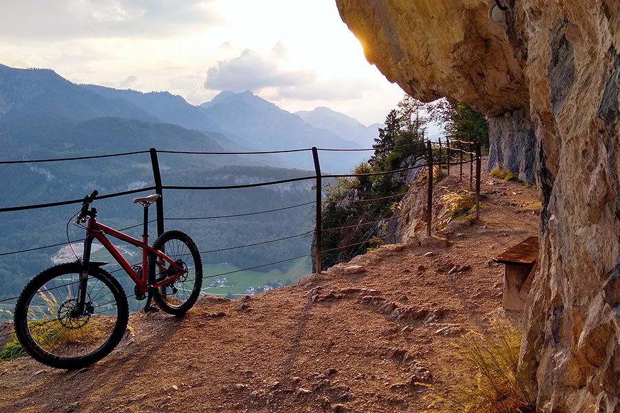
- the Kaiser Tour – 38 km, 770 metres of change in altitude – The tour doesn't just earn its name Kaiser Tour because it leads through the forests and along the paths that Franz and Sis once travelled on foot and by carriage, but primarily because of the highlights it offers. You will see the Ewige Wand and the Tauernweg to Ischl and it has lots of cozy cabins with the Ratluck'n and Hoisenradalm to offer.
- the Sandling-Round - 35 km, 1350 metres of change in altidude – have a break at lake Altausee and a Kaiserschmarrn at the Hütteneck-hut
- the Raschberg Round – 52.50 km, 1,610 metres of change in altitude – Into the Ausseerland and over the challenging Grabenbach back up to the Raschberg – marvelous view of one of the best-known mountain meadows in the Salzkammergut – the Hütteneckalm – the Kaiserschmarrn alone is reason enough for a visit!
- the Durchgangsalm-Round – 48 km, 1380 Hütteneckalm – The tour starts on Lake Hallstatt and leads along the new bike path with a view of the world-famous city of Hallstatt before the path becomes steep in the Echerntal on the way to Gosau – a tour that offers everything – beautiful views, cosy meadows, challenging inclines and declines.
- the Salzkammergut 5 Lake Tour (lake Wolfgangsee, Schwarzensee, etc.) – 60 km, 1350 Hütteneckalm – Mountains and lakes: a combination that the Salzkammergut presents spectacularly, beautiful views and also very appropriate for bikers who without a lot of technical skills.
The team of Landhotel Agathawirt will be happy to help you with your mountain bike plans. Send us your no-obligation enquiry for your mountain bike holidays today.
Mountain bike tours in the Salzkammergut
Find the perfect tour for you. Filter the mountain bike tours according to criteria such as altitude, kilometres, duration, difficulty or riding technique. Then download the tour data as a PDF file or GPS data and look forward to your MTB day in the Salzkammergut.
Kalkalpen Trail Stage 2


4400 Steyr

Kalkalpen Trail Stage 2 - Cultural Landscape: ENNSERHÜTTE - ANLAUFALM
Stage 2 leads from the Ennser Hut over the Gamsstein to the Gschwendt Alm and further over Brunnbach to the Anlaufalm in the Kalkalpen National Park.
Recommended season:
- March
- April
- May
- June
- July
- August
- September
- October
- November
Behind the Ennser Hut, the Danzersteig starts to the right towards Gamsstein. It leads very steeply for about 15 minutes of walking in switchbacks down to a forest road next to the material cable car. You follow the forest road to the left for about 150 m to its end. On a beautiful forest path, it goes slightly downhill to a clearing where there is a small panoramic view towards the Hintergebirge. Then it continues along the ridge behind a small hill, over the so-called Blaulucke.
Below the Gamsstein-Köpfl, the first ascent of the day begins. It goes steeply uphill through the forest in switchbacks. After about half an hour, you have made it and are rewarded with a magnificent panoramic view of the National Park and the Haller Mauern. Before that, surefootedness is briefly required – a few meters go over a rock, but this section is secured with a rope.
At the top, you finally arrive at the Gamsstein Köpfl (1,278 m), the highest point of today's hike, besides the starting point at Ennserhütte. From here, it is just a few steps to the Gamsstein (1,275 m) with a special panoramic view into the Reichraminger Hintergebirge, Sengsengebirge, Haller Mauern, Gesäuse Mountains and on the other side to the Schieferstein, into the Alpine foothills and far into Lower Austria.
Over the pasture, it finally goes down to a hunting hut and then left down a small ditch. Through the forest, you walk along the slope to the alpine pasture. In the middle of the pasture lies the 300-year-old alpine building of the Gschwendtalm (954 m). Not far from the Gschwendtalm, you can find many fossilized corals and brachiopods next to the forest road, which were exposed during excavation.
The dumplings and roast pork from the wood oven at the Gschwendtalm are especially recommended. Strengthened, you walk from the alpine pasture levelly over the meadow into the forest. On the former alpine path, it goes downhill for a few minutes to a junction. Here you turn left into the track and after a few steps finally reach a forest road. Follow the forest road steadily downhill to a crossing, where you keep right. Along the Brunnbach, it now goes comfortably and gently downhill into the small village of Brunnbach. Passing the National Park education center Brunnbachschule, after a few steps you reach the intersection at the Brunnbachstadel. On the large panorama map, you can inform yourself again about the further route. At the Brunnbachstadel, there are also public toilets and rest areas.
The further path leads from the Brunnbachschule, at the Brunnbachstadel junction to the left, about 100 meters along the asphalt road and then turns right over the meadow. Past a barn and over a small bridge, it goes to the other side of the stream. For the first meters, the path now follows the stream and then to the right steeper up the mountain. After a few minutes, you reach a clearing and then through a short wooded area to the Kronsteineralm. There is always a beautiful view of the Almkogel and parts of the Brunnbach valley. The dilapidated alpine building still shows a little of the former alpine life here on the Kronsteineralm. At the end of the pasture, you take the forest road, which you follow to the left.
After a few minutes on the forest road (always a beautiful view of the Almkogel towards the Haller Mauern), the path leads in a sharp right turn straight off the forest road and over a pasture onto an asphalt road. On the right curve, there is a hunting stand and beehives on the left. Now follow the asphalt road for a few minutes until you reach the farmhouse Rauchgrabner at the top. At the farmhouse, the path branches onto a cart track and leads left over the pasture. After about 200 m right at a barn over the meadow up until the path finally merges into the forest at a crossing. After a few meters in the forest, you reach a forest road, which you cross and then continue along the forest path. After only a few minutes, you reach a crossroads. To the right is the Große Klause (trail no. 489) and to the left, the path continues to the Anlaufalm.
On a beautiful forest path, it now goes slightly uphill. On the ridge, you finally reach a small panoramic spot. Not far from there, it goes around a curve and continues on a tractor path that leads into a forest road. You follow this for a few minutes to a junction at the Ortbauernalm (hunting hut). To the right, it goes over the forest road via the Stiegelboden to the Anlaufalm or to the Annerlsteg or also to the Keixen and the Großer Bach. To the left it goes on the forest path or over the Hochkogel to the Anlaufalm.
We follow the path left towards Hochkogel. The first meters still go on the forest road until the hiking trail finally branches left into a forest path. This goes a bit steeper uphill through the forest. After it becomes briefly flatter again, the path to the Hochkogel branches left. Straight ahead you would also continue to the Anlaufalm on trail no. 488, this path is relatively flat and recommended for those who are already a bit tired. To the left, you hike towards Hochkogel on a beautiful forest path uphill to a small meadow and then in steep switchbacks up the forest. Further up it goes along the ridge. At a junction, the path branches down to the Anlaufalm on one side, and on the other up to the summit of Hochkogel. From here it's not far to today's stage goal, but before that, we still walk the 10 minutes to the summit of Hochkogel (1,157 m). This short effort is rewarded with a magnificent panoramic view over the Kalkalpen National Park to the Haller Mauern, Gesäuse Mountains and far north into the Alpine foothills. The Hochkogel is also the border to the Kalkalpen National Park.
From Hochkogel, we take the same path back to the junction, a short piece through the forest and you reach the alpine meadow of Anlaufalm. At the beginning, the view on the right is still limited by trees but after a few steps over the alpine meadow, you already have a beautiful view of the National Park on the right. Straight ahead, you see the Haller Mauern or the Ennstal Alps with Buchstein and Hochtor. Further ahead on a small hill stands a small summit cross. From here it is only a few steps to the stage goal, the Anlaufalm (982 m).
Paths covering:
further information:
- Possible accommodation
Details - hiking
- themed path

Die bewirschaftete Anlaufalm liegt im Reichraminger Hintergebirge und ist über Wanderwege und mit dem Mountainbike gut erreichbar.
Hüttenwirt:in Andi und Melanie
- Für Übernachtung ist bitte eine Reserviergung erforderlich!
Anfragen und Buchungen unter +43 676/335 12 77 - E-Bike Ladestation bei Almgebäude

Unser Natur- und Seminarhotel befindet sich mitten im Grünen, umgeben von tollen Wander- und Radfahrstrecken für jedes Alter. Im Sommer bietet sich der nahe gelegene Reichramingbach zum Abkühlen an und im Winter kann man tolle Schneetouren machen. Seminare bevorzugen die ruhige Lage unseres Hauses.

Die Hüttenwirte Helga und Erwin verwöhnen euch mit frisch am Holzofen zubereiteten Hüttenklassikern. Saisonelle Tagesgerichte, kräftige Suppen, Jaus’n und verschiedene hausgemachte Mehlspeisen – für jeden ist etwas dabei. Je nach Andrang Selbstbedienung oder Bedienung.In der Gaststube, rund um den gemütlichen Kachelofen, haben wir 50 Sitzplätze und im Gastgarten finden um die 100 Wanderer und Biker einen Sonnenplatz. Zum Nächtigen stehen 28 Lagerplätzte (aufgeteilt in mehrere Räume) und 3 Zimmer (mit fisch bezogener Bettwäsche), in welchen auch mit Hunden übernachtet werden kann zur Verfügung.
Zugänge:
Vom Bahnhof Großraming - 3 Std. (Weg Nr. 492)
Vom Bahnhof Küpfern - 4 Std.
NF-Haus Stallburgalm 1 1/2Std.
Gschwendtalm 2 1/2 Std.
Markierte Wege:
Über Gr. Almkogel nach Bodenwies - 6,5 Std.
Über Gr. Almkogel nach Kleinreifling - 3,5 Std.
Über Stallburgalm nach Kastenreith - 3,5 Std.
Leopold Danzer Steig über Gamsstein zur Gschwendtalm - 2,5 Std.(ggfls. Auto stellen)
Besonderheiten:
Kletterwand an der Außenseite der Hütte

Schukosteckdose + 3-polig / 3,7 KW / kostenlos tanken
Zur Betankung von E-Bikes eigenes Ladekabel mitnehmen!

Unser Försterhaus, das am Rande des Nationalpark Kalkalpen liegt, ist der ideale Ort um eine Zeit zu verweilen und den Stress des Alltags zu vergessen. Überzeugen Sie sich selbst von der Vielfalt der Natur die uns umgibt und genießen Sie die Stille unserer Gegend, um zu Ruhe zu kommen. Unser Haus verfügt über 6 Doppelzimmer, jedes der Zimmer ist Vollholz möbliert, alle Zimmer haben eine eigene Dusche, WC, sowie TV.
In unserem neu renovierten Frühstücksraum, der für 20 Personen Platz bietet, findet sich auch eine kleine Kochgelegenheit, wo das eigens mitgebrachte Frühstück, Mittag oder Abendessen genossen werden kann. Somit ist unser Haus ideal für Selbstversorgergruppen, Familien oder auch Seminare.
Die zahlreichen Rad- und Wanderwege rund um unser Haus wollen von Ihnen entdeckt werden, die Wege führen zu wunderschönen Almen, die auf Jedenfall eine Einkehr Wert sind. Unterhalb des Försterhauses, befindet sich der Ausgangspunkt des Kräuter- und Bienenlehrpfades Naturspur, der auf der alten Waldbahnstrecke in Brunnbach errichtet wurde.
Überzeugen Sie sich selbst von der Schönheit unserer Gegend.

Der Brunnbachstadl liegt in der kleinen ruhigen Ortschaft Brunnbach. Die gemütliche Jausenstation ist an Wochenenden und Feiertagen von Mai bis Mitte November geöffnet.
Brunnbachstadl – DER Treffpunkt im Reichraminger Hintergebirge, hier treffen sich herzhafte kulinarische Köstlichkeiten und unglaublich schönes Ambiente! Ein Erlebnis für alle Sinne! Ob eine gemütliche Einkehr nach einer Radtour oder Wanderung oder das Feiern von Festen - bei uns wird alles zu einem ganz besonderen Erlebnis!

Bereits 1912 wurde im Weißenbachtal eine einfache Rollbahn zum Holztransport errichtet. Über diese Strecke ist wenig überliefert, außer, dass der Betrieb ohne Maschinenkraft erfolgte. Der Anstoß zum Bau der Hauptstrecke der Waldbahn kam 1916, als im Brunnbach- und Weißwassergebiet vom Wind 70.000 fm Fichten geworfen wurden. Das meiste Holz blieb, durch den Arbeitermangel im Krieg bedingt, liegen, und so kam es 1919 zu einer Borkenkäferkatastrophe, durch die bis 1922 eine Million Festmeter Holz vernichtet wurde. Von 1919 bis 1923 wurde von der Schallau – dem alten Lager- und Ländeplatz in Reichraming – bis Brunnbach durch das am meisten betroffene Gebiet entlang des Pleissabaches eine einsgesamt 22 km lange Waldbahn gebaut. Abzweigungen ins Weißenbachtal und Richtung Bäckerlager dienten als Zubringer bzw. Verlängerung der Hauptlinie. Mehr über die Waldbahn hier nachlesen!
- Suitable for single travelers
- Suitable for friends
- Suitable for couples
- Spring
- Summer
- Autumn
- Early winter
Please get in touch for more information.
Stadtplatz 27
4400 Steyr
Phone +43 7252 53229 - 0
E-Mailreichraming@steyr-nationalpark.at
Webwww.steyr-nationalpark.at/