Mountain biking tours
Tour tips from mountain bikers for mountain bikers in the Salzkammergut

Your hosts Andrea and Bernhard are well acquainted with the region - Bernhard himself moreover is a certified mountainbike-guide. They both are at your disposal in the mornings and evenings for tour tips for mountain bikers in the Salzkammergut.
Landhotel Agathawirt has a wide range of offers for mountain bikers:
- We offer: 3 guided tours per week in at least 2 ability groups. At least 1 additional easy tour per week for beginners. Euro 85,- per tour and person.
- For e-mountain bikers there are special guided e-mountain bike tours incl. technique training. From 2 persons - Euro 170,- per tour.
Our special mountain biking tour tips
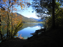
- the Hallstättersee-Koppenwinkel-Round – 30 km, 150 metres of change in altitude – wonderful sight to the village of Hallstatt – nature of Koppenwinkelsee
- the Weissenbach Round – 21 km, 240 metres of change in altitude – our tour for the afternoon after your trip
- the Hochmuth-Round – 23 km, 500 meters of change in altitude – nice tour for half- a – day
- the Blaa-Alm Round– 45.5 km, 960 metres of change in altitude – a classic to get started and get to know the region, but also THE tour to take when it is very hot, since most of the change in altitude has to be conquered at the beginning of the tour and Altaussee Lake is a welcome stop off to cool down

- the Kaiser Tour – 38 km, 770 metres of change in altitude – The tour doesn't just earn its name Kaiser Tour because it leads through the forests and along the paths that Franz and Sis once travelled on foot and by carriage, but primarily because of the highlights it offers. You will see the Ewige Wand and the Tauernweg to Ischl and it has lots of cozy cabins with the Ratluck'n and Hoisenradalm to offer.
- the Sandling-Round - 35 km, 1350 metres of change in altidude – have a break at lake Altausee and a Kaiserschmarrn at the Hütteneck-hut
- the Raschberg Round – 52.50 km, 1,610 metres of change in altitude – Into the Ausseerland and over the challenging Grabenbach back up to the Raschberg – marvelous view of one of the best-known mountain meadows in the Salzkammergut – the Hütteneckalm – the Kaiserschmarrn alone is reason enough for a visit!
- the Durchgangsalm-Round – 48 km, 1380 Hütteneckalm – The tour starts on Lake Hallstatt and leads along the new bike path with a view of the world-famous city of Hallstatt before the path becomes steep in the Echerntal on the way to Gosau – a tour that offers everything – beautiful views, cosy meadows, challenging inclines and declines.
- the Salzkammergut 5 Lake Tour (lake Wolfgangsee, Schwarzensee, etc.) – 60 km, 1350 Hütteneckalm – Mountains and lakes: a combination that the Salzkammergut presents spectacularly, beautiful views and also very appropriate for bikers who without a lot of technical skills.
The team of Landhotel Agathawirt will be happy to help you with your mountain bike plans. Send us your no-obligation enquiry for your mountain bike holidays today.
Mountain bike tours in the Salzkammergut
Find the perfect tour for you. Filter the mountain bike tours according to criteria such as altitude, kilometres, duration, difficulty or riding technique. Then download the tour data as a PDF file or GPS data and look forward to your MTB day in the Salzkammergut.
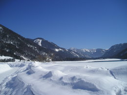
Circular route "Hamoosau - Hintersee"


- pets allowed
- Flatly
- Possible accommodation
Interactive elevation profile
Create PDF
Tour-Details
Paths covering:
hiking rout nr. 46
Länge: 11 km
Höhendifferenz: 100m
Information and hiking map you'll get at the Tourism Office
further information:
- Flatly
- Possible accommodation
- Board possible
Details - hiking
- cleared winter hiking path
daily accessible
")
By car:
Arrival via the West motorway A1, junction Thalgau.
Follow the main road (B 158) in direction to Hof bei Salzburg until you reach the traffic circle “Baderluck”. At the first junction turn into the main road (Hinterseestraße) and after a few kilometers you reach your holiday destination Faistenau.
There are plenty of parking areas near the starting points.
With the Postbus
From Salzburgs bus station, opposite the train station, there is a good bus connection into the
Fuschlsee region and also to Faistenau. You will find details in internet under www.svv-info.at.
With the Train
Information and connections can be found under following addresses www.oebb.at or www.bahn.de
By Air
Salzburg Airport lies very close to Salzburg city. The Bus Nr. 2 brings you from the airport to the main station where you change to continue with the post bus.
no parking fees
- Suitable for groups
- Suitable for schools
- Pets allowed
- Spring
- Summer
- Autumn
Please get in touch for more information.
Circular route "Hamoosau - Hintersee" Tourismusverband Faistenau
Am Lindenplatz 1
5324 Faistenau
Phone +43 6226 8384 - 41
E-Mailfaistenau@fuschlseeregion.com
Webfuschlsee.salzkammergut.at
Webwww.faistenau.at
http://www.faistenau.at
You can also visit us on
Visit us on FacebookInteractive elevation profile
Create PDF
Tour-Details
Paths covering:


