Road biking tours in the Salzkammergut
Various racing bicycle tours in the Salzkammergut region

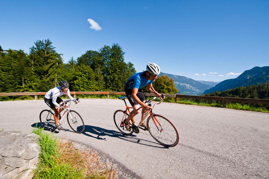
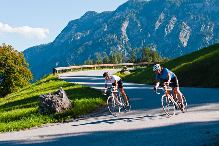
Reel off uncountable kilometres, feel the wind in your helmet and test your physical boundaries: many sportspeople just cannot resist the temptation of the narrow wheels.
Go to new places with your road bike: in the road biking region Salzkammergut you go through wonderful lake and mountain landscapes of a unique variety during your road biking tours.
Bad Goisern – road biking tour to the Attersee variant 1
This beautiful tour takes you to the most beautiful Salzkammergut lakes.
Starting from Landhotel Agathawirt in Bad Goisern you take the main road B145 to the emperor’s town Bad Ischl. At the junction Bad Ischl Nord you take the road to Ebensee / Gmunden. Before reaching Ebensee you turn left into the Weißenbachtal valley (B153) and reach Weißenbach am Attersee. Via Strobl and Bad Ischl you finally go back to Bad Goisern.
Bad Goisern – Attersee with the racing bike variant II - long
The first part of this variant is the same as variant I until Weißenbach am Attersee. Then you cycle anti-clockwise around the Attersee and pass the villages Steinbach, Weyregg, Schörfling and Seewalchen, Attersee, Nussdorf and finally Unterach. Here you take the road to Mondsee. Just as in variant I you then go via Wiesenau and Schafling to St. Gilgen, then on to Strobl and Bad Ischl until you reach Landhotel Agathawirt in Bad Goisern.
Bad Goisern – Strobl on the racing bike
A beautiful and easy racing bike tour from Bad Goisern to Lake Wolfgang and through the emperor’s town Bad Ischl. Along the main road B145 you go slightly downhill to Bad Ischl. On a parallel path to the main road you cross the emperor’s town before you bike on a short stretch of the main road B158 to Pfandl. There you turn right at the traffic lights to the “Alte Wolfgangseestraße” L546. Via Wirling and Radau the road goes to Strobl and from here along the B158 back to the starting point in Bad Goisern.

Obertraun – Bad Aussee road biking tour
This tour leads you through the picturesque Koppental valley.
From the hotel you take the east shore hiking and biking path to Obertraun. There you make a turn to the road leading into the Koppental valley before you conquer the steepest part, the Koppenpass with a challenging gradient of max. 23%. On you go to Bad Aussee and then on the main road B145 towards Bad Goisern. At the traffic junction Bad Goisern Süd you turn to the main road B153 towards Gosaumühle. Here you turn at the junction and go via Hallstatt and Obertraun back to Hotel Agathawirt.
Road bike holidays in Landhotel Agathawirt
Have we wetted your appetite to explore the unique natural landscape of the Dachstein-Salzkammergut with the road bike? Bikers will be very well cared for in Landhotel Agathawirt and will always receive valuable tips for their bike tours by the hosts themselves. Send us a no-obligation enquiry for your holidays in Landhotel Agathawirt in Bad Goisern!
Selected road bike routes around Bad Goisern
Steyr - Spital am Pyhrn | Steyrtal cycle path R8 & Nationalpark Kalkalpen cycle path R31
4400 Steyr

From the river to the mountains - impressive, family-friendly cycling route on the track of the former Steyrtal railway, past the Klaus reservoir over the old railway bridge of the Pyhrn railway, you constantly have the majestic mountains of the Nationalpark Kalkalpen region in view.
Recommended season:
- March
- April
- May
- June
- July
- August
- September
- October
- November
On your saddles, ready, go: Since the connection of the two bike routes R8 and R31, the Steyrtal cycle path is passable for about 75 kilometers - from the iron city Steyr to Spital am Pyhrn.
The family cycle trail R8 and then further the cycle path R31 runs close to the Steyr river with its bathing places, rest stops, experience stations, viewpoints and canyons - from Steyr in the north to Spital am Pyhrn in the south. Due to the mostly flat track, the Steyrtal cycle path is also very suitable for families.
Once the steam locomotive roared here
The section Untergrünburg - Klaus almost continuously follows the track of the Steyrtal railway. Today, this is operated as a museum railway between Steyr and Grünburg. From Klaus, the old 210-meter-long railway bridge was specially adapted for the cycle path connection. To make it suitable for cycling, the old wooden sleepers and posts were removed and replaced by a roadway deck made of sheet metal grates. The stage from Klaus mostly runs close to the elongated reservoir. If you want, you can swim, fish or rent a boat here before reaching the stage destination Steyrling. Back on the main route, it continues to the junction St. Pankraz, where the newly developed Pyhrn-Priel Panorama branches off. We continue on the R8 until you reach the town, where there is a charging station for e-bikes.
ATTENTION: In St. Pankraz, the name and number of the bike path change!
From now on, we ride on the Nationalpark Kalkalpen cycle path R31. Along the Teichl, it goes through forests and a beautiful valley floor towards Spital am Pyhrn. However, we stay on the main route and pass the Roßleithen train station to Windischgarsten. From here, first go right for a bit towards Gleinkersee, then turn left towards Spital am Pyhrn.
Tip:At www.radshuttle.at you can conveniently book the bike shuttle bus on Saturdays/Sundays and public holidays. This will bring you back to the starting point. The current departure times and stops can be found here - please note the shuttle bus can only be booked in advance!
Safety guidelines:Check in advance at www.steyr-nationalpark.at for current road/path closures along the route!
Equipment:Remember rain or sun protection and a bike repair kit for minor breakdowns!Additional information:
Current map material is available at: www.steyr-nationalpark.at
Paths covering:
further information:
- Possible accommodation


- Suitable for groups
- Suitable for schools
- Suitable for teenagers
- Suitable for seniors
- Suitable for single travelers
- Suitable for friends
- Suitable for couples
- Suitable for children
- Spring
- Summer
- Autumn
- Early winter
Please get in touch for more information.
Stadtplatz 27
4400 Steyr
Phone +43 7252 53229 - 0
E-Mailinfo@steyr-nationalpark.at
Webwww.steyr-nationalpark.at/
Webwww.urlaubsregion-pyhrn-priel.at
https://www.urlaubsregion-pyhrn-priel.at


